Bob McDavitt's ideas for sailing around the South Pacific.
Disclaimer: Weather is a mix of pattern and chaos; these ideas are from the
patterned world.
Compiled Sunday 26 December 2021
Sydney to Hobart as challenging as ever: They are off and facing strong
southerly winds and strong eddies of current for their first nigh. 10% of
the initial fleet of 90+ yachts had to retire at the start due to some crew
being close contacts to people who tested positive with the Covid 19 virus.
And in a few days a lull should reach Bass Strait.
The end of 2021
It's been an interesting year, but probably a year that no sailors would
like to repeat.
Next Friday night when you toast your friends and fellow travellers, there
is a less well known verse to Auld lang syne which I'd like you to share:
When translated into English it goes
We two have paddled in the stream,
from morning sun till dine;
But seas between us broad have roared
since the days of auld lang syne.
Enjoy the change in calendar.
TROPICS
There is a strong chance that a new tropical system may develop over
Northern Australia this week. The risk over the South Pacific is less this
week than last week, but likely to increase during January.
WEATHER ZONES
SPCZ=South Pacific Convergence zone.
The SPCZ remains active from Solomons to Tuvalu to Fiji/Samoa.
Tropical Lows over northern Australia may travel East over Queensland.
HIGHS and LOWS
LOW L1 to east of Chathams Island is expected to travel off to the
southeast.
HIGH H1 over northern NZ tonight is travelling east along 35S this week,
allowing a Front and L2 to travel east across NZ on Monday and Tuesday, a
repeat of last week.
HIGH H2 is Australian Bight is expected to travel east along 35S to reach
North Island by New year, following the path of H1/
After a period of SW winds in Opua from late Tues to Friday, looks OK to
arrive there early in Jan.
>>>>>>>>>>>>>>>>>>>>>>>>>>>>>>>>>>>>>>>>>
If you would like more detail for your voyage, then check metbob.com to see
what I offer.
Or Facebook at /www.facebook.com/metbobnz/
Weathergram with graphics is at metbob.wordpress.com (subscribe/unsubscribe
at bottom).
Weathergram archive (with translator) is at weathergram.blogspot.co.nz.
Contact is bob@metbob.com or txt 64277762212
>>>>>>>>>>>>>>>>>>>>>>>>>>>>>>>>>>>>>>>>>>>>>>>>>>>>>>>
25 December 2021
19 December 2021
Bob Blog 19 Dec
Bob McDavitt's ideas for sailing around the South Pacific.
Disclaimer: Weather is a mix of pattern and chaos; these ideas are from the
patterned world.
Compiled Sunday 19 December2021
THE ROLEX SYDNEY HOBART YACHT RACE 2021
There is expected to be a southerly for the start of this years Boxing Day
start to eh Sydney to Hobart yacht race. At this stage the GFS model is
making more of this southerly than the EC model
TROPICS
Tropical cyclone RAI brought a death toll of 76 or more to Philippines last
week and is now recurving in the China Sea and heading towards Taiwan.
There is a strong chance that a new tropical system may develop over Vanuatu
by the end if this week and then could perhaps head for Fiji or south of
Fiji during Christmas or soon after.
WEATHER ZONES
SPCZ=South Pacific Convergence zone.
HIGHS and LOWS
LOW L1 is forming in a trough west of Fiji and is expected to go towards the
northeast of NZ by mid-week and then off to the southeast.
HIGH H1 over northern NZ tonight is travelling east along 35S this week,
allowing L1 to come south in its wake.
LOW L2 is forming in a convergence zone over Southern Cooks around mid-week
and then travelling southwest and south into the zone left behind by the
remains of L1.
LOW L3 is expected to form over northern Vanuatu by the end of the week,
And next weekend there may be a tropical low forming over northern
Queensland.
>>>>>>>>>>>>>>>>>>>>>>>>>>>>>>>>>>>>>>>>>
If you would like more detail for your voyage, then check metbob.com to see
what I offer.
Or Facebook at /www.facebook.com/metbobnz/
Weathergram with graphics is at metbob.wordpress.com (subscribe/unsubscribe
at bottom).
Weathergram archive (with translator) is at weathergram.blogspot.co.nz.
Contact is bob@metbob.com or txt 64277762212
>>>>>>>>>>>>>>>>>>>>>>>>>>>>>>>>>>>>>>>>>>>>>>>>>>>>>>>
12 December 2021
bob blog 12 Dec
Bob McDavitt's ideas for sailing around the South Pacific.
Disclaimer: Weather is a mix of pattern and chaos; these ideas are from the
patterned world.
Compiled Sunday 12 December2021
The first tropical cyclone for this South Pacific cyclone season has just
been named by the Bureau of Meteorology, Australia as RUBY. It is in the
Coral Sea and may reach New Caledonia during Monday night/Tuesday and pass
to the northeast of NZ on Thursday
An active pulse of extra convection, called an MJO (Madden Julian
oscillation) is moving along the equator and should disturb our weather for
the next two to three weeks. The MJO was named in 1971, fifty years ago,
when Roland Madden and Paul Julian studied equatorial wind data. It is a
pulse of extra energy that forms in the Indian Ocean then travels eastwards
along the equator until it fades near the dateline. It can be tracked
watching cloud and rain patterns and is known to increase the risk of
cyclone formation.
At present the zone of extra convection is expected to linger over the
South pacific for the next three weeks.
A site to check is the sophisticated modelling done by Meteo France as shown
on the New Caledonian weather web site at
www.meteo.nc/nouvelle-caledonie/cyclone/coin-des-experts. This shows the
results of a regression model using 2 predictors for the state of the MJO, 3
to measure ENSO and IOD, and one to measure the climatological seasonal
cycle. Their latest map shows that there is a high probability of a cyclone
forming between 19 and 25 dec around Fiji.
EQUATORIAL WESTERLIES
This MJO has triggered a zone of strong west-northwest winds along the
equator. When this happens in December it normally is a precursor to
tropical cyclones. This one has almost produced a twin of tropical
depressions, but these two are perhaps too far apart to feed off each other.
TROPICS
Cyclone RUBY is now the Coral Sea and there is a tropical depression east of
Philippines,
The 'wind accumulation' setting in Windy.com set to next ten days gives an
indication to each model's current forecast for each cyclone path, showing a
storm over Philippines and a gale over New Caledonia is likely this week
WEATHER ZONES
SPCZ=South Pacific Convergence zone.
The SPCZ remains active from Solomons to Fiji. TC RUBY is in the Cora Sea
and expected to pass by northern part of New Caledonia and near Loyalty
Island during Monday night/Tuesday.
HIGHS and LOWS
LOW L1 is just a trough over southern Cooks tonight and is expected to form
on local Monday and go southeast and peak on Wednesday.
HIGH H1as been a blocking high east of NZ last week but is this week
expected to travel off to the northeast.
LOW L2 is in the mid Tasman Sea and expected to cross central NZ on
Wednesday, preceded by an active front on Tuesday night, and followed by a
south to southwest flow on Thu/Fri/Sat.
HIGH H2 is expected to cross Tasmania on Thursday and then go northeast
across the Tasman Sea. into south Tasman Sea this weekend and then follows
H1.
L3 is expected to travel from 50s to 55s, south of Tasmania on Wednesday and
south of NZ by Friday.
The outlook for next week is that ANOTHER TROPICAL LOW may from and travel
south near Vanuatu, and another trough may cross the Tasman Sea. Time your
travel to avoid these.
>>>>>>>>>>>>>>>>>>>>>>>>>>>>>>>>>>>>>>>>>
If you would like more detail for your voyage, then check metbob.com to see
what I offer.
Or Facebook at /www.facebook.com/metbobnz/
Weathergram with graphics is at metbob.wordpress.com (subscribe/unsubscribe
at bottom).
Weathergram archive (with translator) is at weathergram.blogspot.co.nz.
Contact is bob@metbob.com or txt 64277762212
>>>>>>>>>>>>>>>>>>>>>>>>>>>>>>>>>>>>>>>>>>>>>>>>>>>>>>>
05 December 2021
Bob Blog 5 dec
Bob McDavitt's ideas for sailing around the South Pacific.
Disclaimer: Weather is a mix of pattern and chaos; these ideas are from the
patterned world.
Compiled Sunday 5 December 2021
REVIEW OF THE LAST MONTH (November 2021)
As an addendum for my review of November: MetService and NIWA confirm that
November 2021 was the warmest November on record in New Zealand, and BoM in
Australia confirm it was the wettest November on record in Australia.
ATMOSPHERIC RIVERS
These have been streaming cloud across the north pacific recently from the
tropics to Western US and Canada, bringing record-breaking rainfall.
The NOAA weather map on 4 Dec shows a 1044hPa HIGH and a Low bringing a cold
front to Hawaii
which triggered a blizzard warning for Mauna Kea.
See
www.sfgate.com/hawaii/article/blizzard-warning-flooding-kona-low-Hawaii-1667
2184.php
A Kona Low is a subtropical cyclone that can feed south to southwest winds
onto Hawaiian Islands.
TROPICS
TC NYATOH formed east of Philippines last Monday and travelled north and
faded by last Friday.
TC TERATAI briefly formed last Wednesday to southwest of Jakarta. It was the
second named storm for the Australian area this season, with PADDY being the
first, in the South Indian Ocean from 22-24 November.
There are zones of potential development east of Philippines and over
Solomons as a burst of extra convection is expected to arrive in the western
pacific over the next week or so because of an incoming MJO. The GFS and EC
models are now picking that a tropical Low is likely to form between Solomon
Islands and northern Vanuatu late this week and this might then deepen and
go southeast next week. More on this next Sunday, but those who have been
delaying their tropical exit this season should heed the signs and get
going.
WEATHER ZONES
SPCZ=South Pacific Convergence zone.
The SPCZ is becoming more intense this week and expected to drift south onto
Fiji to Southern Cooks.
HIGHS and LOWS
LOW L1 south of Tahiti is expected to linger around 30S and fade late in the
week.
TROF from central Tasman Sea to central NZ on Monday is expected to go off
to the east-southeast.
HIGH H1 east of Tasmania is NZ is expected to swing past southern NZ on
Tuesday and rebuild along 40S across the Pacific.
LOW L2 is expected move off inland Australia and deepen east of Sydney by
Thursday then travel across South Island by Saturday, leaving a centre west
of Westland.
HIGH H2 is get into south Tasman Sea this weekend and then follows H1.
L3 is expected to form between Solomon Islands and northern Vanuatu later
this week and deepen and go southeast next week.
Looks OK to sail to Opua and arrive before Tuesday 14 Dec, but there may be
strong winds and heavy swells over northern NZ 15-16 Dec.
>>>>>>>>>>>>>>>>>>>>>>>>>>>>>>>>>>>>>>>>>
If you would like more detail for your voyage, then check metbob.com to see
what I offer.
Or Facebook at /www.facebook.com/metbobnz/
Weathergram with graphics is at metbob.wordpress.com (subscribe/unsubscribe
at bottom).
Weathergram archive (with translator) is at weathergram.blogspot.co.nz.
Contact is bob@metbob.com or txt 64277762212
>>>>>>>>>>>>>>>>>>>>>>>>>>>>>>>>>>>>>>>>>>>>>>>>>>>>>>>
03 December 2021
<> Negative SEO Services <>
If you ever need Negative SEO Serrvices, we offer it here
https://liftmyrank.co/negative-seo-services/
Unsubscribe:
https://mgdots.co/unsubscribe/
https://liftmyrank.co/negative-seo-services/
Unsubscribe:
https://mgdots.co/unsubscribe/
28 November 2021
Bob Blog 28 Nov
Bob McDavitt's ideas for sailing around the South Pacific.
Disclaimer: Weather is a mix of pattern and chaos; these ideas are from the patterned world.
Compiled Sunday 28 November 2021
REVIEW OF THE LAST MONTH (November 2021)
Sea surface temperature in the eastern equatorial Pacific are showing the cool eddies of a LA NINA episode. This is surrounded by a C-shaped zone of warmth from north of Hawaii to Indonesia to south of Fiji. And there is now a warm zone from Madagascar to southwest of Australia.
To see how the annual weather cycle and the seasons are working out, we can check the average isobar maps for past 30 days and their anomaly from psl.noaa.gov/map/clim/glbcir.quick.shtml
Northern Europe is showing typical winter change with intensification of a High over China.
The southern hemisphere subtropical ridge is shifting south for the summer, most notably in the Australian bight.
The anomaly map shows there are now fewer lows forming around Australia than last month.
The main change in the past month has been the extension of the subtropical ridge southwards into the Australian Bight Also, the 1010 isobar has shifted south and east from Indonesia to northern Australia and Samoa.
TROPICS
We are continuing with the typical November hiatus with no cyclones around at present.
Winter storm ARWEN has been bringing damage to UK with a northerly gale.
WEATHER ZONES
SPCZ=South Pacific Convergence zone.
The SPCZ is stretching from PNG across Solomon Islands and northern Vanuatu to Samoa and Tuamotu Islands.
a
HIGHS and LOWS
LOW L1 south of Tahiti is travelling SE and deepening, stealing the wind from the tropics and moving a convergence zone onto Tahiti by mid-week.
HIGH H1 east of NZ is moving east along 35to 40S west of L1.
LOW L2 in Tasman Sea is expected to travel across central NZ on Tuesday and then fade and get pushed off to the north.
LOW L3 is expected to develop around Tuvalu by mid-week and then travel southeast and deepen south of Southern Cooks by end of the week.
HIGH H2 is expected to move from Tasmania around southern NZ by mid-week and then go northeast, making a squash zone with L3
After L2 it looks Ok to sail westwards to Australia or southwards from Fiji to Opua until next trough arrives around Fri 10 Dec.
>>>>>>>>>>>>>>>>>>>>>>>>>>>>>>>>>>>>>>>>>
If you would like more detail for your voyage, then check metbob.com to see what I offer.
Or Facebook at /www.facebook.com/metbobnz/
Weathergram with graphics is at metbob.wordpress.com (subscribe/unsubscribe at bottom).
Weathergram archive (with translator) is at weathergram.blogspot.co.nz.
Contact is bob@metbob.com or txt 64277762212
>>>>>>>>>>>>>>>>>>>>>>>>>>>>>>>>>>>>>>>>>>>>>>>>>>>>>>>
21 November 2021
Bob Blog 21 Nov
Bob McDavitt's ideas for sailing around the South Pacific.
Disclaimer: Weather is a mix of pattern and chaos; these ideas are from the
patterned world.
Compiled Sunday 21 November 2021
In the illustrated edition at
metbob.wordpress.com/2021/11/21/bob-blog-21-nov/ there are to screen shots
of EUMETSAT satellite imagery showing long lines of patterned cumulus,
chaotic cumulonimbus, and speckled squalls.
TROPICS
We are continuing with the typical mid-November hiatus with no cyclones
around at present.
WEATHER ZONES
SPCZ=South Pacific Convergence zone.
The SPCZ is stretching from PNG across Solomon Islands and northern Vanuatu
to Samoa.
A convergence zone over French Polynesia by mid-week is expected to move
towards Niue late in the week.
HIGHS and LOWS
LOW L1 south of Rarotonga is travelling SE and deepening, stealing the wind
from the tropics and moving a convergence zone onto Tahiti by mid-week.
HIGH H1 east of NZ is moving east along 35to 40S faster than L1.
LOW L2 just south of Noumea tonight is expected to travel southeast to east
of NZ and then go east following the L1/H1 combo.
LOW L3 is just west of South Island tonight and expected to cross NZ on
Monday and then move off to the east southeast.
HIGH H2 is expected to move from Tasmania to central NZ by mid-week and then
go northeast, allowing LOW L4 to spread from inland Australia to Tasman
Sea/southern NZ by end of the week.
After L2 it looks Ok to sail westwards to Australia or southwards from Fiji
to Opua until around Wed 1 Dec.
>>>>>>>>>>>>>>>>>>>>>>>>>>>>>>>>>>>>>>>>>
If you would like more detail for your voyage, then check metbob.com to see
what I offer.
Or Facebook at /www.facebook.com/metbobnz/
Weathergram with graphics is at metbob.wordpress.com (subscribe/unsubscribe
at bottom).
Weathergram archive (with translator) is at weathergram.blogspot.co.nz.
Contact is bob@metbob.com or txt 64277762212
>>>>>>>>>>>>>>>>>>>>>>>>>>>>>>>>>>>>>>>>>>>>>>>>>>>>>>>
14 November 2021
Bob Blog 14 Nov
Bob McDavitt's ideas for sailing around the South Pacific.
Disclaimer: Weather is a mix of pattern and chaos; these ideas are from the
patterned world.
Compiled Sunday 14 November 2021
NZ immigration has reduced the required managed hotel isolation Q time from
14 days to 7 days for those flying in , and to 10 days for yachts with
time-spent-at-sea counting, so this will help those sailing into NZ from
overseas.
Tomorrow the South Indian Cyclone season nominally starts and lasts until 30
April 2022.
Last Wednesday the equatorial westerly winds in the Indian Ocean helped
produce a twinning of lows near 10degrees north and 10 degrees south
The Flooding of Australia
It has only taken a week and one muggy and windy low to bring wind and rain
affecting half of Australia as reported here
www.9news.com.au/national/weather-forecast-australia-eastern-states-brace-fo
r-second-day-of-heavy-rain-with-potential-of-more-flooding-and-hail/e61b0587
-f468-4334-b820-710b8645dec1
the Low broke many rainfall records, even Alice Springs got over 100mm in a
day, Perth got a double monthly average rainfall in one day and top weekly
accumulation was 440mm at Samuel Hill in coastal Queensland,
TROPICS
We are having the typical mid -November hiatus with no cyclones around at
present.
WEATHER ZONES
SPCZ=South Pacific Convergence zone.
The SPCZ is stretching from PNG across Solomon Islands and northern Vanuatu
to Samoa.
A convergence zone over French Polynesia is expected to fade by mid-week.
A low, L3, is likely to form between New Caledonia and Fiji by Saturday and
then travel southeast to be east of the North Island by Monday 22 Nov.
Looks Ok to sail to NZ from the tropics this week or next week, but avoid
L3.
HIGHS and LOWS
HIGH H1 between Fiji and NZ is moving east along 32S.
LOW L1 980 in south Tasman Sea-the one that flooded much of Australia - is
travelling ESE across the south of NZ, making a zone of strong westerly
winds over NZ until Tuesday turning SW on Wednesday and Thursday.
HIGH H2 is expected to form east of New South Wales on Wednesday and then
travel east across the North Island on Friday.
LOW L2 is expected to be in the Australia Bite by mid-week, cross Tasmania
on Thursday and turn into a trough reaching the Tasman Sea to South Island
by Saturday.
>>>>>>>>>>>>>>>>>>>>>>>>>>>>>>>>>>>>>>>>>
If you would like more detail for your voyage, then check metbob.com to see
what I offer.
Or Facebook at /www.facebook.com/metbobnz/
Weathergram with graphics is at metbob.wordpress.com (subscribe/unsubscribe
at bottom).
Weathergram archive (with translator) is at weathergram.blogspot.co.nz.
Contact is bob@metbob.com or txt 64277762212
>>>>>>>>>>>>>>>>>>>>>>>>>>>>>>>>>>>>>>>>>>>>>>>>>>>>>>>
07 November 2021
Bob Blog 7 Nov
Bob McDavitt's ideas for sailing around the South Pacific.
Disclaimer: Weather is a mix of pattern and chaos; these ideas are from the
patterned world.
Compiled Sunday 07 November 2021
Note that FIJI is NOT changing to Daylight saving (had been planned 14 Nov
2021 to jan 16 2022). This was announced on 10 October However Microsoft may
not have enough time to implement this change in time, so if it affects you
and you have a device using Fiji time, then be aware that it may still
change to daylight saving on 14 Nov, and perhaps turn off "Adjust for
daylight saving automatically" in date and time settings.
Now that we are in the Cyclone season, interest is rising on when the first
cyclone may develop.
A good indicator to this is the MJO (Madden Julian oscillation). Named in
1971, when Roland Madden and Paul Julian discovered a pulse of extra energy
that travels east wards along the tropics from Indian Ocean to Pacific
Ocean. It is a regional scale coupling between atmospheric circulation and
tropical convection. It is known to increase the risk of cyclone formation
and can be tracked watching cloud and rain patterns.
A good site to see its extrapolated trend is
www.cpc.ncep.noaa.gov/products/precip/CWlink/MJO/foregfs.shtml, scroll down
to Ensemble map of the OLR (outgoing long wave radiation) anomolies. Here,
blue is bubbly and yellow is mellow. At present the next MJO is expected to
reach Papua New Guinea between 10 and 15 November and maybe weaken after
that. This is probably too early in the season to trigger anything.
These MJO pulses tend to be 4 to 6 weeks apart, so , with some hand-waving,
there is an indication of one around the end of December, and that is indeed
a time of moderate risk for cyclone formation.
Another site to check is the sophisticated modelling done by Meteo France as
shown on the New Caledonian weather web site at
www.meteo.nc/nouvelle-caledonie/cyclone/coin-des-experts. This shows the
results of a regression model using 2 predictors for the state of the MJO, 3
to measure ENSO and IOD, and one to measure the climatological seasonal
cycle.
This map shows that there is a slight increased risk of cyclone formation
around Western Australia between 21 and 27 November, but not by much.
TROPICS
The latest cyclone activity report is at tropic.ssec.wisc.edu and Tropical
Cyclone Potential is from www.ssd.noaa.gov/PS/TROP/TCFP/index.html
WANDA is weakening and heading for Ireland. It is the end of this years
alphabet, and any more named features around North America this year will
come from a supplementary alphabet (from Adia to Will). There are potential
zones for formation west of Sumatra at 5N and 5S,
WEATHER ZONES
SPCZ=South Pacific Convergence zone.
The SPCZ is narrower than normal this week, mainly around Eastern Fiji and
Northern Tonga.
A convergence zone over French Polynesia is moving off to the east.
A trough between Fiji and east of New Zealand is expected to drift
eastwards.
HIGHS and LOWS
HIGH H1 was a blocking High last week at near 40S 160W and is expected to
weaken and go east this week.
LOW L1 has been trapped east of North Island for a few days and should peel
off to the southeast and east this week.
HIGH H2 west of South Island is expected to get south of Chathams by
mid-week then go east, followed by warm northerly flow over Tasman Sea and
NZ.
LOW L2 is forming off Sydney tonight and expected to deepen as it crosses
the Tasman Sea then go across the South Island by Friday, with associated
front crossing North Island and northern Tasman Sea on Saturday.
HIGH H3 should form over northern Tasman Sea later this week.
LOW L3 is expected to deepen off Sydney by Friday.
Avoid arriving in Northland on Sat/Sun 13/14 Nov
>>>>>>>>>>>>>>>>>>>>>>>>>>>>>>>>>>>>>>>>>
If you would like more detail for your voyage, then check metbob.com to see
what I offer.
Weathergram with graphics is at metbob.wordpress.com (subscribe/unsubscribe
at bottom).
Weathergram archive (with translator) is at weathergram.blogspot.co.nz.
Contact is bob@metbob.com or txt 64277762212
>>>>>>>>>>>>>>>>>>>>>>>>>>>>>>>>>>>>>>>>>>>>>>>>>>>>>>>
31 October 2021
Bob Blog 31 Oct
Bob McDavitt's ideas for sailing around the South Pacific.
Disclaimer: Weather is a mix of pattern and chaos; these ideas are from the
patterned world.
Compiled Sunday 31 October 2021
REVIEW OF THE LAST MONTH (October 2021)
Sea surface temperature in the eastern equatorial Pacific are showing the
coolness of an incoming LA NINA episode. This is surrounded by a C-shaped
zone of warmth from north of Hawaii to Indonesia to south of French
Polynesia.
Average isobars for past month :Northern Europe is showing seasonal change
with intensification of a High around Siberia. There is a noticeable
weakening of the southern hemisphere subtropical ridge over Australia. The
anomaly map shows there have been lows forming over eastern Australia.
Zooming into the NZ area
The lowering of pressure about and east of Australia is REMARKABLE, as has
been the amount of damaging weather there during October.
TROPICS
WANDA is zigzagging across the North Atlantic.
WEATHER ZONES
SPCZ=South Pacific Convergence zone.
The SPCZ stretches from PNG to northern Vanuatu, to Samoa and drifting
between Tuamotu Islands and Society Islands. A passing trough is expected to
visit Fiji mid-week.
HIGHS and LOWS
High H1 should linger near 35S 140-160W until mid-week then move off to
east.
Low L1 southeast of the South Island is expected to move off to the
southeast, allowing a strong cold southerly onto southern NZ on Monday.
Low 2 is expected to deepen to northeast of North Island by end of Tuesday,
bringing a strong SE flow over the North Island on Wednesday and Thursday.
High H2 east of New South Wales tomorrow is expected to travel southeast
towards Chathams by mid-week, combining with L2 to strengthen SE flow over
North Island.
Avoid arriving in Northland on Wed/Thu this week and on Friday 12 Nov.
>>>>>>>>>>>>>>>>>>>>>>>>>>>>>>>>>>>>>>>>>
If you would like more detail for your voyage, then check metbob.com to see
what I offer.
Or Facebook at /www.facebook.com/metbobnz/
Weathergram with graphics is at metbob.wordpress.com (subscribe/unsubscribe
at bottom).
Weathergram archive (with translator) is at weathergram.blogspot.co.nz.
Contact is bob@metbob.com or txt 64277762212
>>>>>>>>>>>>>>>>>>>>>>>>>>>>>>>>>>>>>>>>>>>>>>>>>>>>>>>
24 October 2021
Bob Blog 24 Oct
Bob McDavitt's ideas for sailing around the South Pacific.
Disclaimer: Weather is a mix of pattern and chaos; these ideas are from the
patterned world.
Compiled Sunday 24 October 2021
A DOUBLE DIP LA NINA LIKELY
We had a LA NINA episode last summer, and it now looks likely we are heading
for another LA NINA episode this coming summer.
See
www.scoop.co.nz/stories/WO2110/S00220/pacific-likely-to-experience-double-di
p-la-nina-episode.htm for more details.
During a LA NINA the trade winds are stronger than normal, feeding
sun-drenched warm water westwards. This also increases the upwelling around
the eastern equatorial pacific (EEP), so that sea surface temperatures are
cooler than normal there.
The South Pacific Convergence zone SPCZ is likely to shift to south and west
of normal, from Coral Sea to northern Tonga to southern Cooks.
Having two LA NINA episodes in a row (a "double-dip" LA NINA0 is unusual.
TROPICS
RICK is intensifying and expected to make landfall over west coast of Mexico
on local Monday.
WEATHER ZONES
SPCZ=South Pacific Convergence zone.
The SPCZ stretches from PNG to Tuvalu to Samoa and drifting from Society
Islands to Southern Cooks.
Good trade winds over South Pacific this week.
HIGHS and LOWS
Trough over northern NZ tonight should fade away on Monday.
High H1 has been lingering over Chathams area for a few days and should
travel slowly northeast this week.
Low L1 east of Tasmania is expected to travel east reaching central NZ by
Thursday then northeast across the North Island on Friday, following H1.
High H2 is expected to travel NE to east of South Island late in the week,
following L1.
High H3 is expected to travel east across the northern Tasman Sea from
Tuesday to Saturday.
Low L2 is expected to travel southeast over Tasmania on Friday.
Avoid arriving at Opua on Monday 1 Nov due passing trough followed by
southerlies, or on Wed 3/Thursday 4 Nov due possible strong easterly winds.
>>>>>>>>>>>>>>>>>>>>>>>>>>>>>>>>>>>>>>>>>
If you would like more detail for your voyage, then check metbob.com to see
what I offer.
Or Facebook at /www.facebook.com/metbobnz/
Weathergram with graphics is at metbob.wordpress.com (subscribe/unsubscribe
at bottom).
Weathergram archive (with translator) is at weathergram.blogspot.co.nz.
Contact is bob@metbob.com or txt 64277762212
>>>>>>>>>>>>>>>>>>>>>>>>>>>>>>>>>>>>>>>>>>>>>>>>>>>>>>>
17 October 2021
Bob blog 17 Oct
Bob McDavitt: Bob McDavitt's ideas for sailing around the South Pacific.
Disclaimer: Weather is a mix of pattern and chaos; these ideas are from the
patterned world.
Compiled Sunday 17 October 2021
South Pacific coming Cyclone season Nov 2021 to April 2022.
During the past week NIWA and MetService of New Zealand, along with BoM from
Australia, issued a combined news release giving their outlook for the
coming South Pacific Cyclone season.
For details see tinyurl.com/SouthPacificOutlook2022
In summary, the agencies say there is a good chance that we will be having a
LA NINA episode during next six months. NOAA have already declared this to
have developed along with an 87% to continue into February 2022 (see
tinyurl.com/NCEPENSO).
Combine this with recent Sea surface temperature anomolies across the South
Pacific, and it is logical to forecast that the South Pacific Convergence
zone SPCZ is likely to be south and west of its normal position , enhancing
the cyclone risk for western countries and reducing the risk east of the
dateline.
From around 50 years of data, 6 analogue years with similar La Nina and Sea
surface temperature coupling were picked, Showing the first cyclones may
form around New Caledonia and Queensland coast, and later in the season the
zone from Queensland coast across the Coral Sea to between Vanuatu and Fiji
may be favoured.
Looking at atmospheric dynamics combining several models shows the outlook
for isobar anomolies from Jan to Mar 2022 Indicates lows are likely to
develop or deepen between New Caledonia and New Zealand.
And the forecast rain map for January to March shows the South Pacific
Convergence zone from Coral Sea to northern Tonga, with a finger towards
northern New Zealand.
In summary, the expected number of cyclones over the South Pacific is
between 9 and 12, slightly above normal:
A passing MJO (Madden Julian Oscillation = burst of tropical convection that
travels eastwards from Indian Ocean to Pacific Ocean around once a month) is
likely to provide us with times when risk of cyclone formation may peak.
TROPICS
NAMTHEUN is weakening over the open ocean in the far north Pacific.
WEATHER ZONES
SPCZ=South Pacific Convergence zone.
The SPCZ stretches from PNG to Tuvalu to Samoa and may visit Tahiti this
week.
Active trough over southern Cooks is expected to linger near Tahiti from
mid-week and form L2 that should go off to the SE
Active trough is expected to form over New Caledonia from Mid-week and
develop L4 near 40S/New Zealand.
HIGHS and LOWS
L1 about southern NZ tonight and associated trough over North Island
travelling off to the southeast followed by a west to southwest flow.
High1 east of NZ is expected to travel off to the east along 40S by
mid-week.
L3 is expected to travel northeast out of the Southern Ocean to 35S in the
wake of H1.
High2 should reach South Tasman Sea by Wednesday and travel east along 45S
to be near Chathams by the weekend.
After Wednesday, L4 complicates trans-Tasman travel, and L4 and H2 should
produce a NE flow between Fiji and NZ.
>>>>>>>>>>>>>>>>>>>>>>>>>>>>>>>>>>>>>>>>>
If you would like more detail for your voyage, then check metbob.com to see
what I offer.
Or Facebook at /www.facebook.com/metbobnz/
Weathergram with graphics is at metbob.wordpress.com (subscribe/unsubscribe
at bottom).
Weathergram archive (with translator) is at weathergram.blogspot.co.nz.
Contact is bob@metbob.com or txt 64277762212
>>>>>>>>>>>>>>>>>>>>>>>>>>>>>>>>>>>>>>>>>>>>>>>>>>>>>>>
10 October 2021
Bob Blog 10 Oct
Bob McDavitt's ideas for sailing around the South Pacific.
Disclaimer: Weather is a mix of pattern and chaos; these ideas are from the
patterned world.
Compiled Sunday 10 October 2021
Bureau of Meteorology outlook for coming cyclone season around Australia
From tcoutlook.com/australia/latest-outlook/
Predictors
Recently ENSO has been neutral. Models are now indicating a 67% to 87%
chance of a LA NINA episode from Nov 2021 to Jan 2022neutral conditions. La
Nina typically results in increased cyclone activity in Australia and in the
South Pacific west of the dateline.
In spite of this, the Long-Range Tropical Cyclone Outlook for Australia
(TCO-AU) suggests near-normal cyclone activity around Australia for the Nov
2021 to April 2022 period, with between 8 and 13 cyclones.
TROPICS
TC LIONROCK has been crossing the China Sea and may make landfall onto north
part of Vietnam. KOMPASU has formed east of Manila and is expected to affect
northern Philippines. NAMTHEUN has formed around Micronesia and is expected
to curve off to the northeast.
WEATHER ZONES
SPCZ=South Pacific Convergence zone.
The SPCZ is less active but more spread out than last week.
Active trough between Fiji and Samoa on local Monday is expected reach
Southern Cooks by local Tuesday with Low L1 near 25S and this then moves off
to the southeast leaving a large lull in its wake.
HIGHS and LOWS
High1 north of NZ on Monday is expected to travel northeast to 25S and then
east maintaining a lull in the wake of L1.
Low L2 is expected to form south of NZ in a trough crossing the South Island
on Monday and then deepen to 980 east of South Island on Tuesday/Wednesday
feeding polar chilled southerly winds onto NZ, then moving off to the east.
High H2 should follow L2 and then travel NE of NZ by Saturday, providing
good conditions for arriving in Opua early next week.
Low L3 is expected to travel east across Bass Strait and into the southern
Tasman by the end of the week.
>>>>>>>>>>>>>>>>>>>>>>>>>>>>>>>>>>>>>>>>>
If you would like more detail for your voyage, then check metbob.com to see
what I offer.
Or Facebook at /www.facebook.com/metbobnz/
Weathergram with graphics is at metbob.wordpress.com (subscribe/unsubscribe
at bottom).
Weathergram archive (with translator) is at weathergram.blogspot.co.nz.
Contact is bob@metbob.com or txt 64277762212
>>>>>>>>>>>>>>>>>>>>>>>>>>>>>>>>>>>>>>>>>>>>>>>>>>>>>>>
03 October 2021
Bob Blog 3 Oct
Bob McDavitt's ideas for sailing around the South Pacific.
Disclaimer: Weather is a mix of pattern and chaos; these ideas are from the
patterned world.
Compiled Sunday 03 October 2021
REVIEW OF THE LAST MONTH (September 2021)
Sea surface temperature continue to get cooler than normal around the
eastern equatorial Pacific, and that's a hint to a possible LA NINA episode
for the coming cyclone season. A warm pool is starting to build in the
central South Pacific and that may help to tug the South Pacific Convergence
zone eastwards towards French Polynesia.
To see how the annual weather cycle and the seasons are working out, we can
check the average isobar maps for past 30 days and their anomaly from
psl.noaa.gov/map/clim/glbcir.quick.shtml
It's up and down: In the Pacific the northern subtropical ridge has
weakened, and the southern subtropical ridge has intensified near south
America. The southern subtropical ridge has intensified in the Indian Ocean
and weakened in the Atlantic.
The anomaly map shows more HIGHS east of r NZ and lower pressures along 50S
from south of NZ all the way to south of Africa, and that increases the
westerly flow along 45 to 50S.
The drop in pressure over inland Asia is interesting.
Zooming into the NZ area shows the 1015 line shifting south over northern
Australia and north over NZ, indicating spring is in the air with lulls in
the wind over Timor Sea and increased westerly winds over NZ.
TROPICS
There are still some areas of high potential for formation around
Philippines. TC SAM and VICTOR are in the North Atlantic, and SHAEEN-GU is
about to make landfall on northern Somalia.
WEATHER ZONES
SPCZ=South Pacific Convergence zone.
The SPCZ is more active than last week especially from Vanuatu to Fiji until
midweek and then from Solomons to Samoa and over French Polynesia by the
weekend.
HIGHS and LOWS
High1 to east of NZ is expected to travel east along 35S maintaining a good
SE flow between Tahiti and Tonga until mid-week.
Trof1 is expected to cross New Zealand on Monday and move off the southeast.
Low1 is expected to form off Sydney by late Monday and travel SSE to south
of NZ late in the week followed by another trough reaching NZ by Saturday
and a more active Low by Mon 11 Oct.
Low2 is expected to form south of Tahiti late in the week and move off to
the south
Trough2 is expected to cross the northern Tasman Sea on Tuesday. New
Caledonia on Wednesday and Tonga on Friday, leading in High2.
High2 is travelling east across Australia along 30S and should cross the
Tasman Sea along 30 to 35S from Wednesday reaching northern NZ by the
weekend.
>>>>>>>>>>>>>>>>>>>>>>>>>>>>>>>>>>>>>>>>>
If you would like more detail for your voyage, then check metbob.com to see
what I offer.
Or Facebook at /www.facebook.com/metbobnz/
Weathergram with graphics is at metbob.wordpress.com (subscribe/unsubscribe
at bottom).
Weathergram archive (with translator) is at weathergram.blogspot.co.nz.
Contact is bob@metbob.com or txt 64277762212
>>>>>>>>>>>>>>>>>>>>>>>>>>>>>>>>>>>>>>>>>>>>>>>>>>>>>>>
26 September 2021
Bob Blog 26 Sep
Bob McDavitt's ideas for sailing around the South Pacific.
Disclaimer: Weather is a mix of pattern and chaos; these ideas are from the
patterned world.
Compiled Sunday 26 Sept 2021
Equinox was as 7:20am NZ time on Thu 23 Sept. This marks the instant that
the overhead sun is directly over the equator, shifting from the northern
hemisphere to the southern hemisphere.
In New Zealand the change to NZDT Daylight time occurred at 2am this morning
(3am NZDT). The clocks sprung ahead an hour and so for us today is a 23hour
day.
The change to daylight saving occurs on different dates for the nations
around the South Pacific so I think it's a good idea for you to have a
summary for reference
Date Place Daylight saving time
zone
Sun 26 Sep New Zealand UTC+13 (NZDT)
Sun 26 Sep Chatham Islands UTC+13h45mins (CHADT)
Sun 3 Oct New South Wales, Tasmania UTC+11 (AEDT)
Note that Queensland, Western Aus and Northern Territory do NOT observe
Daylight saving.
Sun 3 Oct Lord Howe Is. UTC+11 (AEDT) (30 minute
ahead)
Sun 3 Oct Norfolk Island UTC+12 (AEDT)
Sun 14 Nov Fiji UTC+13 (Fiji Summer Time
FJST)
Note that Fiji reverts to standard time on Sun 16Jan 2022.
No changes in New Caledonia, Tonga or American Samoa or Vanuatu.
Samoa did have some daylight saving during the last few years but NONE
PLANNED this summer.
October is the month that yachts plan to leave the tropics for the
approaching South Pacific Cyclone Season, nominally on 1 November (starting
at low risk). Planning for departure from Fiji or French Polynesia is
complicated due to requirements for PCR Covid tests, etc. and so it is
useful to have a summary of the various national holidays for next few
months.
From East to west, LOCAL DATES
French Polynesia Mon 1 Nov All Saints Day, Thurs 11 Nov Armistice Day
Cook Islands: Tue26 Oct Gospel Day
Niue: Tue Oct 19 to Fri 22 Oct for Constitution Day celebrations, Fri 22Oct
is Gospel Day.
American Samoa Mon 11 Oct Columbus Day
Samoa Mon 11 Oct White Sunday (mondayised)
Tonga Thurs Nov 4 Constitution Day, Mon 6 Dec King Tupou I Day
Fiji Mon 11 Oct Fiji Day, Mon 18 Oct Prophet Mohammed's Birthday (starts in
evening),
Thu 4 Nov Diwali.
Vanuatu Tue 5 Oct Constitution Day, Mon 29 Nov National Unity Day
New Caledonia Mon 1 Nov All Saints Day, Thurs 11 Nov Armistice Day.
New Zealand Mon 25 Oct Labour Day.
Australia: Mon 4 OCT Labour Day (ACT, NSW &SA), Queen's Birthday (QLD)
TROPICS
Cyclone PETER faded near Bermuda and then TERESA rose from its remnants.
SAM seems have more strength than PETER/TERESA but should stay offshore.
MINDULLE may well sideswipe eastern Japan this week.
GULAB is expected to fade over Northeastern India.
WEATHER ZONES
SPCZ=South Pacific Convergence zone.
The SPCZ is expected to more active than last week, and slowly shift south
onto Fiji mid-week then drift north again.
Low south of southern Cooks tonight is expected to peel off to the southeast
by mid=week and associated trough may cross Tahiti around mid-week.
Trough associated with L3 is expected to travel eastwards across northern
Tasman Sea late in the week and reach New Caledonia by the weekend.
HIGHS and LOWS
LOW1 is a complex low south of Southern Cooks that should fade as it moves
SE.
HIGH1 starts the week east of NZ and should intensify as it tracks to the
southeast.
LOW2 is expected to form off the North Island East Coast on Monday and
deepen to below 995 neat Chatham Island by Wed then weaken as it goes off to
the southeast.
HIGH2 over 1025 tonight is expected to travel northeast across the Tasman
Sea and the eastwards along 35S across northern NZ and can be used to sail
west or east across the Tasman Sea.
LOW3 is expected to move off New South Wales from Thursday and deepen in
central Tasman Sea this weekend and may then travel northeast onto Northland
early next week. Avoid.
>>>>>>>>>>>>>>>>>>>>>>>>>>>>>>>>>>>>>>>>>
If you would like more detail for your voyage, then check metbob.com to see
what I offer.
Or Facebook at /www.facebook.com/metbobnz/
Weathergram with graphics is at metbob.wordpress.com (subscribe/unsubscribe
at bottom).
Weathergram archive (with translator) is at weathergram.blogspot.co.nz.
Contact is bob@metbob.com or txt 64277762212
>>>>>>>>>>>>>>>>>>>>>>>>>>>>>>>>>>>>>>>>>>>>>>>>>>>>>>>
19 September 2021
Bob Blog 19 Sep
Bob McDavitt's ideas for sailing around the South Pacific.
Disclaimer: Weather is a mix of pattern and chaos; these ideas are from the
patterned world.
Compiled Sunday 19 Sept 2021
SUCKERS and PUFFERS
Can you tell the difference between a sucker cloud and a puffer cloud?
Clouds that grow upwards into the sky are called cumulus clouds. They start
off as fluffy white ones.
Once they get sufficiently tall they produce a shower of rain.
If conditions are strongly unstable this shower may become heavy, perhaps
with hail, or thundery or squally.
These small cumulus clouds can be called suckers because that have a zone of
calm on their leading edge. As a sucker approaches the wind speed gradually
drops away. When you see these clouds, try and sail around and between them
rather than under them.
As you look into the surface wind, the cloud will creep to your right (in
the southern hemisphere). This is because it is propelled by the stronger
upper winds. Friction causes the surface wind to "leak to low pressure" and
be to be to the left of the winds aloft. When sailing upwind, put the wind
to starboard (go left) to avoid the approaching calm, and aim for the LEFT
edge of the cloud to catch the extra winds on its rear.
The taller clouds can be called puffers. Once the turrets grow to be taller
than their base, they can start producing rain in the colder upper region,
this rain falls and drags with it a downdraft that fans out from the back
end of the cloud like a waterfall.
As the downdraft ahead of a puffer reaches you, surface winds suddenly
increases. There is a direction-shift around the shoulders of the cloud, and
a huge calm zone that trails behind it. When sailing upwind into an
approaching puffer, remember to do the "squall checklist" --- put things
away-reef the rig--- check the compass-and watch the wind on the water
ahead. When the first puff of the downdraft appears, put the wind on
starboard (go left) so that we are sailing away from the puffer. We may get
lifted for a few minutes as we go around the shoulder of the cloud but keep
aiming to the left so we avoid being caught in the trailing calm zone.
TROPICS
Cyclone PETER is expected to peel off to the northeast and may swipe past
Bermuda.
WEATHER ZONES
SPCZ=South Pacific Convergence zone.
The SPCZ stretches from Solomona to Tuvalu to Samoa to Southern Cooks, in
its normal position.
Trough over Niue to Southern Cooks tonight expected to get onto French
Polynesia by mid-week and form a low that travels off to the south by end of
the week.
Trough reaching New Caledonia by mid-week is expected to reach Tonga/Niue
area by end of week.
HIGHS and LOWS
HIGH1 above 1024 to north of NZ is moving ESE along 30 to 35S followed by H2
travelling along 30S. This maintains useful trade winds this week north of
15S.
LOW1 is expected to form near Lord Howe by Tuesday and deepen to 995 as it
crosses central NZ on Wed/Thursday/by Wednesday in mid Tasman. Avoid.
Associated trough may form new low east of North Island and south of Niue by
end of week.
>>>>>>>>>>>>>>>>>>>>>>>>>>>>>>>>>>>>>>>>>
If you would like more detail for your voyage, then check metbob.com to see
what I offer.
Or Facebook at /www.facebook.com/metbobnz/
Weathergram with graphics is at metbob.wordpress.com (subscribe/unsubscribe
at bottom).
Weathergram archive (with translator) is at weathergram.blogspot.co.nz.
Contact is bob@metbob.com or txt 64277762212
>>>>>>>>>>>>>>>>>>>>>>>>>>>>>>>>>>>>>>>>>>>>>>>>>>>>>>>
12 September 2021
Bob Blog 12 Sep
Bob McDavitt's ideas for sailing around the South Pacific.
Disclaimer: Weather is a mix of pattern and chaos; these ideas are from the
patterned world.
Compiled Sunday 12 Sept 2021
La Nina may be coming back
What is a La Nina?
When the Pacific trade winds are stronger-than-normal they drag sun-warmed
sea surface to the west, encouraging upwelling of cooler deeper water around
the Galapagos. This can go on for months and is called a "La Nina" episode.
It shifts the subtropical ridge away from the equator.
The reverse of this, with less trade winds and warmer-than-normal seas
around the Galapagos, is called "El Nino". The comings and goings of these
episodes can last several months, maybe over a year, and so their status can
be used to help forecast the weather for the coming season.
The Ocean:
The sea surface temperatures in the equatorial eastern Pacific are
near-normal, but there is a zone of cooler-than-normal sub-surface water
that indicates conditions are starting to edge towards La Nina.
The Atmosphere:
ENSO = El Nino/Southern Oscillation. The Southern Oscillation Index SOI (30
day running mean) sums up the whole weather pattern over the South Pacific
into one number. It is based on the standardized difference in the barometer
readings between Tahiti and Darwin, in other words it counts the average
number of isobars between them on the weather map. When the SOI is more than
plus one(standard deviation from its mean) for more than a month we call it
a LA NINA event, and when it stays more than minus one we call it an EL NINO
event. These graphs from longpaddock.qld.gov.au multiply the SOI by 10, and
show a LANINA episode (>10) from Nov 2020 to Feb 2021, then near-zero March
to June then a strong positive swing in July and a relaxation in August.
There has been a positive swing so far in September.
The NCEP CFSv 2 and North American Multi-Model Ensemble show that a weak LA
NINA is likely in the next few months with a 70-80% chance of La Nina from
Oct 2021 to Feb 2022.
So we seem to be on the edge of a new La Nina. At this time of the year the
Tasman Sea / NZ area is having its usual spring weather pattern with a ridge
/trough cycle and strong NW and SW winds, with each trough followed by a
burst of SW swell reaching into the subtropics. If this La Nina clicks in as
forecast then these troughs may weaken and shift south bringing this area an
early start to summer-type conditions. NZ's climate agency NIWA is
forecasting larger than normal HIGH pressure systems about and east of NZ
for the next few months, and this is consistent with an incoming La Nina.
TROPICS
CONSON and CHANCHU (Kiko) formed over the Philippines. CHANCHU as Cat 5 for
a while and is now travelling northwards off Taiwan and heading for
Shanghai.
WEATHER ZONES
SPCZ=South Pacific Convergence zone.
The SPCZ stretches from Solomona to Tuvalu to Samoa to Southern Cooks.
Trough to north of L1 is expected to reach New Cal by Wednesday and Tonga
area by Saturday.
HIGHS and LOWS
HIGH1 above 1024 to NE of NZ is moving ESE along 30 to 40S followed by H3
travelling along 30S. this maintains useful trade winds this week between
Tahiti and Niue.
LOW1 is expected to form offshore of Coffs by Tuesday and deepen to 995 by
Wednesday in mid Tasman then travel ESE and weaken east of Northland by
Saturday. Avoid.
LOW2 below 970hPa at 55S is bringing a NW gale to Canterbury tonight and
its trough is travelling east of NZ next few days.
HIGH2 over 1024 over Tasmania by Wednesday is expected to cross the South
Tasman and get east of the South Island by Saturday, combining like an
eggbeater to produce a vigorous SE flow over eastern North Island and thru
Cook Strait.
>>>>>>>>>>>>>>>>>>>>>>>>>>>>>>>>>>>>>>>>>
If you would like more detail for your voyage, then check metbob.com to see
what I offer.
Or Facebook at /www.facebook.com/metbobnz/
Weathergram with graphics is at metbob.wordpress.com (subscribe/unsubscribe
at bottom).
Weathergram archive (with translator) is at weathergram.blogspot.co.nz.
Contact is bob@metbob.com or txt 64277762212
>>>>>>>>>>>>>>>>>>>>>>>>>>>>>>>>>>>>>>>>>>>>>>>>>>>>>>>
07 September 2021
Advanced SEO plans
Off the shell SEO plans to increase your website`s SEO Metrics and Ranks
within just 1 month
See more details here
https://liftmyrank.co/affordable-seo-services-small-businesses/
Unsubscribe:
please send a blank email to RonaldLilly7162@gmail.com
you will be automatically unsubscribed
within just 1 month
See more details here
https://liftmyrank.co/affordable-seo-services-small-businesses/
Unsubscribe:
please send a blank email to RonaldLilly7162@gmail.com
you will be automatically unsubscribed
05 September 2021
Bob Blog 5 sept
Bob McDavitt's ideas for sailing around the South Pacific.
Disclaimer: Weather is a mix of pattern and chaos; these ideas are from the
patterned world.
Compiled Sunday 05 September 2021
REVIEW OF THE LAST MONTH (August 2021)
SST: The warming trend in North Pacific shifted northwards during August
from Japan to the Aleutians, with a warm pool lingering north of Hawaii.
There as some cooling around the eastern equatorial Pacific but not enough
to form a LA NINA. Not much change in the Southern Hemisphere.
ISOBARS: The northern subtropical ridge has weakened and gone south in the
Atlantic. In the southern hemisphere the subtropical ridge has weakened in
the Indian Ocean but intensified and gone south over Australia and NZ. The
Antarctic HIGH has weakened.
In a reversal of July's anomolies, pressures in August were ABOVE NORMAL
over Tasman Sea/NZ, central south Atlantic and south of Japan. August also
brought more lows than normal to Canada and western North America.
Zooming into the NZ area
Over the Tasman Sea, despite the higher valued isobars the pressure
gradient/wind flow is much the same as last month. The seasonal outlook is
for more westerly winds in the coming months.
TROPICS
Hurricane IDA took a damaging track across USA with a death toll of near 60
and flash flooding in New York.
LARRY is in mid north Atlantic and should peel off to the northeast, but its
remnants may sideswipe Novia Scotia.
WEATHER ZONES
SPCZ=South Pacific Convergence zone.
Part of the SPCZ is over Fiji tonight and travelling southeast where it
should form a low near 25S by Tuesday.
Otherwise, the SPCZ this week stretches from Solomona to Tuvalu to Samoa.
HIGHS and LOWS
HIGH over 1030 east of NZ expected to travel east along 35 to 40S with a
squash zone of enhanced easterly to northeasterly winds near 25 to 30S.
LOW below 1005 in southwestern Tasman Sea tonight and associated trough
expected to cross NZ on Mon/Tues followed by vigorous westerly flow then
another trough on Friday, followed by SW flow on Saturday.
HIGH 1030 expected by Thursday to travel east into northern Tasman Sea along
30S south passing north of NZ of NZ on Friday.
Lookout for a deepening LOW to form in Tasman Sea on 12 Sept and cross
northern NZ on 13-14 Sep. Avoid.
>>>>>>>>>>>>>>>>>>>>>>>>>>>>>>>>>>>>>>>>>
If you would like more detail for your voyage, then check metbob.com to see
what I offer.
Or Facebook at /www.facebook.com/metbobnz/
Weathergram with graphics is at metbob.wordpress.com (subscribe/unsubscribe
at bottom).
Weathergram archive (with translator) is at weathergram.blogspot.co.nz.
Contact is bob@metbob.com or txt 64277762212
>>>>>>>>>>>>>>>>>>>>>>>>>>>>>>>>>>>>>>>>>>>>>>>>>>>>>>>
29 August 2021
Bob Blog 29 Aug
Bob McDavitt's ideas for sailing around the South Pacific.
Disclaimer: Weather is a mix of pattern and chaos; these ideas are from the
patterned world.
Compiled Sunday 29 August 2021
SPCZ The South Pacific convergence zone
The SPCZ has two main drivers:
A: HIGH "A" that is located west of South America (I call it the Andes High
because it is held in place by the Andes Mountain range). It is quasi
stationary, just like the High between California and Hawaii, and also has a
gyre that is collecting a rubbish heap just as badly especially about
Henderson/Pitcairn Islands see
blogs.fco.gov.uk/lauraclarke/2018/04/10/henderson-island-plastic-pollution-i
n-paradise/).
B: The HIGHS that migrate along around 30 South from off Australia eastwards
into the Pacific.
What is happening is that the air that rotates around HIGH "A" produces a
northeast flow over the Marquises to Tahiti area and this converges into the
south/southeasterly air flow that is produced on the leading eastern and
northern sides of the "B" Highs .
This produces a convergence zone that stretches roughly from Solomons
islands to Southern Cooks.
Things to know about the SPCZ
1: The SPCZ has an annual cycle, going more to the north in winter and more
to the south in summer.
2: It also gets tugged northwards in an El Nino and southwards in a La Nina.
3: There is a pulse of extra convections that travels eastwards along it
around once every 3 to 6 weeks calls the MJO or Madden Julian Oscillation -
powerful enough to trigger tropical cyclones during summer.
4: The strength and position of the SPCZ is constantly changing with A and
B.
5: Around once a month or so an extra strong B High with a central pressure
over 1030 hPa pushes the isobars on its north side closer together making
what I call a SQUASH ZONE of enhanced trade winds in the tropics. This
squash zone travels eastwards with the Highs. This is called Bogi walu in
Fiji or Aho Valo in Tonga or Mara'umu in French Polynesia.
6: And it can become extra squally with the help of passing troughs that
follow the migration of lows in the Southern Ocean.
Read more about it at en.wikipedia.org/wiki/South_Pacific_convergence_zone
When sailing from Tahiti to Fiji, an encounter with the SPCZ is inevitable
and may be considered as a rite of passage. The trick is to work out in
advance some waypoints that avoid its nastier parts. This requires skill
obtained from practice. Global computer models tend to average out this
convergence and show it as a misleading zone of quieter winds, whereas it
can be squally.
I have found that the easiest way to determine the position and severity of
the SPCZ is to watch satellite imagery (IR imagery shows the squalls). If
you can receive small sized emails at sea, you can download small sized
satellite images as follows
Send an email to query@saildocs.com (no subject needed) with one of the
following messages:
-> Infrared image 140E to 145W and from 10N to 35S updated every 10 minute
(46Kb).
SEND https://www.y2ksail.com/himawari/latest-SpacificLarge-small.jpg
-> Infrared image 140E to 160W and from 0S to 25S updated every 10 minutes
(40kb).
SEND https://www.y2ksail.com/himawari/latest-pacific3-small.jpg
-> FIJI Infrared image updated every 10 minutes (15Kb)
SEND https://www.y2ksail.com/himawari/latest-fiji-small.jpg
I recommend that you test these and check out the y2ksail.com web site
before departure from Tahiti. Also, to help decide what the SPCZ may do for
the next few says I use the 5-day rain accumulation parameter (e.g., on
windy.com)
TROPICS
Hurricane NORA is making landfall over Baja California, and Hurricane IDA is
heading for New Orleans,
after slamming Cuba. Tropical Depression TEN is heading north in mid
Atlantic.
WEATHER ZONES
SPCZ=South Pacific Convergence zone.
The SPCZ stretches from Solomona to Tuvalu to Samoa to Southern Cooks.
Trough from the southwest is expected to reach south of Southern Cooks by
mid-week and then form a low near 40S that will travel off to southeast.
HIGHS and LOWS
HIGH 1024 near 35S160W tonight is moving off to the east. High 1024 in North
Tasman Sea for Tuesday to Thursday with a squash zone of elevated trade
winds in Coral Sea strait.
LOW 1002 in mid-Tasman tonight contains thundery showers that are fading. It
is expected to travel NE to Auckland by Tuesday and then to north of NZ and
fade away by end of week.
HIGH south of NZ is expected to travel northeast and build to over 1036 east
of NZ by midweek and then to 35S 160W by end of the week. It is expected to
bring a strong squash zone between southern Cooks and southern Tonga from
the weekend. Avoid.
>>>>>>>>>>>>>>>>>>>>>>>>>>>>>>>>>>>>>>>>>
If you would like more detail for your voyage, then check metbob.com to see
what I offer.
Or Facebook at /www.facebook.com/metbobnz/
Weathergram with graphics is at metbob.wordpress.com (subscribe/unsubscribe
at bottom).
Weathergram archive (with translator) is at weathergram.blogspot.co.nz.
Contact is bob@metbob.com or txt 64277762212
>>>>>>>>>>>>>>>>>>>>>>>>>>>>>>>>>>>>>>>>>
Disclaimer: Weather is a mix of pattern and chaos; these ideas are from the
patterned world.
Compiled Sunday 29 August 2021
SPCZ The South Pacific convergence zone
The SPCZ has two main drivers:
A: HIGH "A" that is located west of South America (I call it the Andes High
because it is held in place by the Andes Mountain range). It is quasi
stationary, just like the High between California and Hawaii, and also has a
gyre that is collecting a rubbish heap just as badly especially about
Henderson/Pitcairn Islands see
blogs.fco.gov.uk/lauraclarke/2018/04/10/henderson-island-plastic-pollution-i
n-paradise/).
B: The HIGHS that migrate along around 30 South from off Australia eastwards
into the Pacific.
What is happening is that the air that rotates around HIGH "A" produces a
northeast flow over the Marquises to Tahiti area and this converges into the
south/southeasterly air flow that is produced on the leading eastern and
northern sides of the "B" Highs .
This produces a convergence zone that stretches roughly from Solomons
islands to Southern Cooks.
Things to know about the SPCZ
1: The SPCZ has an annual cycle, going more to the north in winter and more
to the south in summer.
2: It also gets tugged northwards in an El Nino and southwards in a La Nina.
3: There is a pulse of extra convections that travels eastwards along it
around once every 3 to 6 weeks calls the MJO or Madden Julian Oscillation -
powerful enough to trigger tropical cyclones during summer.
4: The strength and position of the SPCZ is constantly changing with A and
B.
5: Around once a month or so an extra strong B High with a central pressure
over 1030 hPa pushes the isobars on its north side closer together making
what I call a SQUASH ZONE of enhanced trade winds in the tropics. This
squash zone travels eastwards with the Highs. This is called Bogi walu in
Fiji or Aho Valo in Tonga or Mara'umu in French Polynesia.
6: And it can become extra squally with the help of passing troughs that
follow the migration of lows in the Southern Ocean.
Read more about it at en.wikipedia.org/wiki/South_Pacific_convergence_zone
When sailing from Tahiti to Fiji, an encounter with the SPCZ is inevitable
and may be considered as a rite of passage. The trick is to work out in
advance some waypoints that avoid its nastier parts. This requires skill
obtained from practice. Global computer models tend to average out this
convergence and show it as a misleading zone of quieter winds, whereas it
can be squally.
I have found that the easiest way to determine the position and severity of
the SPCZ is to watch satellite imagery (IR imagery shows the squalls). If
you can receive small sized emails at sea, you can download small sized
satellite images as follows
Send an email to query@saildocs.com (no subject needed) with one of the
following messages:
-> Infrared image 140E to 145W and from 10N to 35S updated every 10 minute
(46Kb).
SEND https://www.y2ksail.com/himawari/latest-SpacificLarge-small.jpg
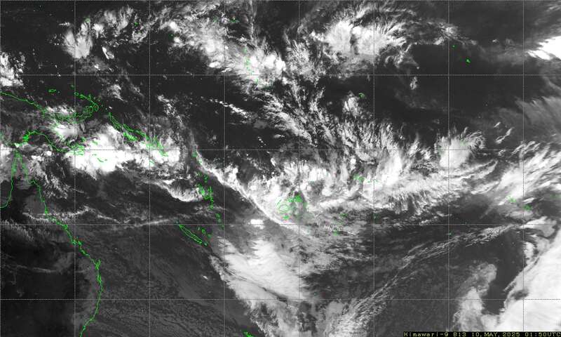
-> Infrared image 140E to 160W and from 0S to 25S updated every 10 minutes
(40kb).
SEND https://www.y2ksail.com/himawari/latest-pacific3-small.jpg
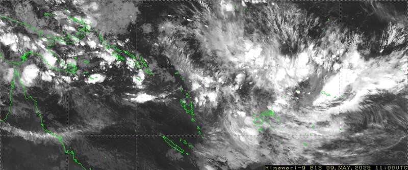
-> FIJI Infrared image updated every 10 minutes (15Kb)
SEND https://www.y2ksail.com/himawari/latest-fiji-small.jpg
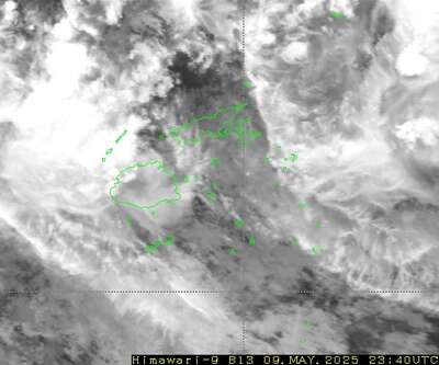
I recommend that you test these and check out the y2ksail.com web site
before departure from Tahiti. Also, to help decide what the SPCZ may do for
the next few says I use the 5-day rain accumulation parameter (e.g., on
windy.com)
TROPICS
Hurricane NORA is making landfall over Baja California, and Hurricane IDA is
heading for New Orleans,
after slamming Cuba. Tropical Depression TEN is heading north in mid
Atlantic.
WEATHER ZONES
SPCZ=South Pacific Convergence zone.
The SPCZ stretches from Solomona to Tuvalu to Samoa to Southern Cooks.
Trough from the southwest is expected to reach south of Southern Cooks by
mid-week and then form a low near 40S that will travel off to southeast.
HIGHS and LOWS
HIGH 1024 near 35S160W tonight is moving off to the east. High 1024 in North
Tasman Sea for Tuesday to Thursday with a squash zone of elevated trade
winds in Coral Sea strait.
LOW 1002 in mid-Tasman tonight contains thundery showers that are fading. It
is expected to travel NE to Auckland by Tuesday and then to north of NZ and
fade away by end of week.
HIGH south of NZ is expected to travel northeast and build to over 1036 east
of NZ by midweek and then to 35S 160W by end of the week. It is expected to
bring a strong squash zone between southern Cooks and southern Tonga from
the weekend. Avoid.
>>>>>>>>>>>>>>>>>>>>>>>>>>>>>>>>>>>>>>>>>
If you would like more detail for your voyage, then check metbob.com to see
what I offer.
Or Facebook at /www.facebook.com/metbobnz/
Weathergram with graphics is at metbob.wordpress.com (subscribe/unsubscribe
at bottom).
Weathergram archive (with translator) is at weathergram.blogspot.co.nz.
Contact is bob@metbob.com or txt 64277762212
>>>>>>>>>>>>>>>>>>>>>>>>>>>>>>>>>>>>>>>>>
22 August 2021
Bob Blog 22 Aug
Bob McDavitt's ideas for sailing around the South Pacific.
Disclaimer: Weather is a mix of pattern and chaos; these ideas are from the
patterned world.
Compiled Sunday 22 August 2021
BREAKERS (on the coast) and swimming
Usually, it is the slope of the beach that determines the type of breakers:
Spilling, plunging or surging. These notes are from
www.seafriends.org.nz/oceano/waves.htm
. Spilling breakers: result from waves of low steepness (long period swell)
over gentle slopes. They cause rows of breakers, rolling towards the beach.
Such breakers gradually transport water towards the beach during groups of
high waves. Rips running back to sea, transport this water away from the
beach during groups of low waves. When caught swimming in a rip, do not
attempt to swim back to shore because such rips can be very strong (up to 8
km/hr). Swim parallel to the beach towards where the waves are highest. This
is where water moves towards the beach. The next group of tall waves should
assist you to swim back to shore. However, when launching (rescue) boats,
this is best done in a rip zone.
. Plunging breakers: result from steeper waves over moderate slopes. The
slope of a beach is not constant but may change with the tide. Some beaches
are steep toward high tide, others toward low tide. A plunging breaker is
dangerous for swimmers because its intensity is greatly augmented by
backwash from its predecessor. This strong backwash precludes easy exit from
the breaker zone, particularly for divers. Often a steep bank of loose sand
prevents one from standing upright. In order to exit safely, wait for a
group of low waves.
. Surging breakers: occur where the beach slope exceeds wave steepness. The
wave does not really curl and break but runs up against the shore while
producing foam and large surges of water. Such places are dangerous for
swimmers because the rapidly moving water can drag swimmers over the rocks.
When waves break, their energy is absorbed and converted to heat. The
gentler the slope of the beach, the more energy is converted. Steep slopes
such as rocky shores do not break waves much but do reflect them back to
sea, which 'shelters' marine life.
TROPICS
The latest cyclone activity report is at tropic.ssec.wisc.edu and Tropical
Cyclone Potential is from www.ssd.noaa.gov/PS/TROP/TCFP/index.html
It has been a busy week in the tropics. GRACE brought damaging winds to east
coast of Mexico, killing eight people. FRED brought flooding to North
Carolina, killing at least 2. The remains of LINDA are passing by to north
of Hawaii tonight. HENRI is heading for New York and New England, and OMAIS
is heading for South Korea. There is also a strong potential for possible
formation across the North Atlantic.
WEATHER ZONES
SPCZ=South Pacific Convergence zone.
The SPCZ is expected to build and stretch from Solomona to Tuvalu to Samoa
to Southern Cooks.
Trough south of Southern Cooks expected to form a low near 25S south of
Palmerston/Aitutaki that will travel off to southeast.
HIGHS and LOWS
HIGH over 1034 east of NZ and north of Chatham Island is a slow-moving block
and should take all week to travel NE from 43S to 33S.
LOW down to below 994 forming off Newcastle on Mon/Tue and travel across
Tasman Sea and then stall and fade west of the North Island this weekend
(due the blocking High).
Then by Friday a multi-centred HIGH is expected to travel east with #1
centre to SE of Tasmania and #2 over New South Wales. These should continue
east with #1 going around south of South Island and to east of South Island
next week, and with #2 fading in north Tasman Sea.
Looks like we may be having more dominant HIGHS in Tasman Sea over the next
few weeks, good tropical trade winds.
>>>>>>>>>>>>>>>>>>>>>>>>>>>>>>>>>>>>>>>>>
If you would like more detail for your voyage, then check metbob.com to see
what I offer.
Or Facebook at /www.facebook.com/metbobnz/
Weathergram with graphics is at metbob.wordpress.com (subscribe/unsubscribe
at bottom).
Weathergram archive (with translator) is at weathergram.blogspot.co.nz.
Contact is bob@metbob.com or txt 64277762212
>>>>>>>>>>>>>>>>>>>>>>>>>>>>>>>>>>>>>>>>>>>>>>>>>>>>>>>
21 August 2021
Whitehat Monthly SEO plans for your business
Hi there
I have just checked your site for the ranking keywords and found that you
could use a nice boost in the SEO trend and the organic visibility
If interested in getting more out of your online business, kindly hit reply
thanks and regards
Mike
I have just checked your site for the ranking keywords and found that you
could use a nice boost in the SEO trend and the organic visibility
If interested in getting more out of your online business, kindly hit reply
thanks and regards
Mike
15 August 2021
Monthly SEO Plans
Just checked your website and it could really use a boost
If you ever need Google updates free whitehat SEO plans, we are the right
team for you
Results oriented monthly plans to make your SEO trend climb like never
before
https://conversion-seo.co/seo-packages/
Unsubscribe:
please send a blank email to RonaldLilly7162@gmail.com
you will be automatically unsubscribed
Bob Blog 15Aug
Bob McDavitt's ideas for sailing around the South Pacific.
Disclaimer: Weather is a mix of pattern and chaos; these ideas are from the
patterned world.
Compiled Sunday 15 August 2021
More about waves
Last week I mentioned that shorter period waves are steeper and less
manageable.
I also mentioned that a sharply inclined seabed encourages breaking waves.
You can feel this increased choppiness when approaching land and crossing
the continental shelf.
This requires further explanation,
1. As you approach land, the swell arriving from the open ocean
interacts with the reflections of waves that bounce (rather than break) on
the coast, and this produces a diffraction pattern and increased choppiness.
1) There is usually a difference in the height of sea level on either
side of a continental shelf. This is maintained by strong ocean surface
currents sometimes as a series of eddies. When these currents flow against
the wind the waves that are produced are made steeper. A knot of current
builds the wave height up as much as a 10 knot increase in wind. =
I had a few readers reply to lat week's blog with stories of their own
encounter with steepening seas.
Rory recalls being off the Portuguese coast on a winter yacht delivery in
the 90s. Sailing south into a southerly gale, we tried going into the coast
to get some relief. Nope, inshore conditions were worse, so we headed back
to the ocean, As we crossed the continental shelf we sailed over two of the
biggest waves I have seen in 40 years of sailing. they were two very
organised swells that stretches as far as could be seen in both directions.
The first was just a very steep and impressive swell. But the second was
breaking at various points along its length, big enough to roll us.
Fortunately, we were between the breaking sections.
Stan writes about a trip across the Tasman Sea in March 2019. Finally
approaching land after a five-day passage, on a moon-less night and with
seasick crew, and being on the helm for over 12 hours, we continued
(doggedly) directly westwards to get ashore. But increasing wind from the
north and a strong current from the south meant a steepening sea. In
daylight we realised the sea state and altered course to the south so that
the swell was behind us. The sea would suddenly settle down, and then build
again dramatically. In retrospect we realised this was due to our transiting
areas with less current. As the waves settled in those area, we turned
westward towards Sydney. It was during one of these periods going west that
I looked to starboard and saw a large wave approaching directly on our beam.
When the wave was about 50m from the boat it suddenly combined with a wave
from a slightly different direction and the manageable 5m wave became an 8m
wall of water, nearly vertical and ready to break. We didn't have time to
turn into this monster and it hit us directly on the right side. We listed
to the side as far as we've ever experienced and at the top, luckily, we
proceeded over to the back of the wave. The lesson: If our course is into an
area of increased risk, be prepared to change course early, especially when
wind speed is greater than 30 knots.
Full blog is at buffalonickelblog.com/2019/03/24/crossing-the-tasman-sea/
Finally, a note about wave height. This is given in marine weather
forecasts as "significant metres". The significant wave height Hs is
defined as the mean height of highest third of the waves. In practical
terms it is the average height of the waves you can see. Using the Rayleigh
distribution Hs gives us a handle from which we can work out the probability
of wave height.
So 1 wave in 7 is higher than Hs, or around 1 per minute The occasional
wave, 1.5*Hs is 1 in 100 waves, or around 1 in 15 minutes The maximum wave,
2*Hs is 1 in over 1000 waves around once a day.
And to experiment with interference and diffraction patterns play with a
ripple simulator at www.falstad.com/ripple/ (simulates sound , radio and
microwaves but not sea waves. Click and drag the mouse to make waves).
TROPICS
Haiti is about to be hit by Cyclone GRACE soon after a very damaging
earthquake see edition.cnn.com/2021/08/14/world/haiti-earthquake/index.html
The remnants of FRED is heading for Louisiana.
LINDA is a very active system travelling westwards n the NE tropical
Pacific.
And SIXTEEN is a depression heading westwards across the NW tropical Pacific
towards Philippines.
WEATHER ZONES
SPCZ=South Pacific Convergence zone.
The SPCZ is expected to build and stretch from Solomona to Tuvalu to Samoa.
Trough forming over Fiji and Tonga from mid-week and travelling east to
reach Southern Cooks by local Friday. A low may form in this trough near
30S.
HIGHS and LOWS
H1 is a High above 1025 north of NZ tonight and expected to travel southeast
to east of NZ maintaining good trade winds for much of this week.
T1 is a broad trough that is expected to travel over the Tasman Sea and NZ
on Monday and Tuesday and the further east triggering a trough in the
tropics.
H2 is a HIGH that is expected to enter the central Tasman Sea from Australia
by Thursday and build to 1030+ over NZ this weekend. It is good for getting
across the Tasman Sea. However, it may bring a squash zone to the tropics on
its northern side. The EC model is at present producing a LOW to southeast
of Fiji early next week, but this may change. Be aware.
T2 is a trough that is expected over Tasmania by Thursday and then travel
fast east across NZ on Friday and then further off to the East.
>>>>>>>>>>>>>>>>>>>>>>>>>>>>>>>>>>>>>>>>>
If you would like more detail for your voyage, then check metbob.com to see
what I offer.
Or Facebook at /www.facebook.com/metbobnz/ Weathergram with graphics is at
metbob.wordpress.com (subscribe/unsubscribe at bottom).
Weathergram archive (with translator) is at weathergram.blogspot.co.nz.
Contact is bob@metbob.com or txt 64277762212
>>>>>>>>>>>>>>>>>>>>>>>>>>>>>>>>>>>>>>>>>>>>>>>>>>>>>>>
08 August 2021
Bob blog 8 Aug 2021
Bob McDavitt's ideas for sailing around the South Pacific.
Disclaimer: Weather is a mix of pattern and chaos; these ideas are from the
patterned world.
Compiled Sunday 8 August 2021
SWELL PERIOD
For about a year now, MetService have been mentioning when swells have a
long period (more than 12 seconds). A blog explaining why is at
blog.metservice.com/Swell-Period
Basically, swell is waves coming from over the horizon. Storms can generate
a spectrum of waves of different directions and heights, and these "sort
themselves out" over time to organise swells that may travel for days. The
swell being generated by a wintry SW flow in the Tasman Sea tonight will
take a great circle and arrive in San Diego around 14 days from now. The
period of a waves is the time it takes to travel past a point. Longer period
swells are further apart and thus have gentler slopes, however, they travel
faster and contain more energy. Thus when they roll onshore they break more
heavily, making beach, bar and reef conditions more hazardous. Also, vessels
longer than one wavelength are prone to resonant motions causing rolling and
pitching.
Sea waves have short periods (7 seconds or less) producing choppy conditions
and hazards to shorter vessels. The shorter the period the steeper the wave.
When the wave is too steep it becomes unstable and BREAKS.
Using the graph calculated by Dr. Dilip Barua and published in NATURE at
widecanvas.weebly.com/nature/archives/06-2018
For a 2m swell steepness becomes unmanageable when period is less than 7
seconds.
Then the relationship is approximately linear, so add six to height in
metres to get minimum safe period in seconds..
For a 3m swell minimum safe period is 9 seconds. 4m,10secs. 5m,11 sec. 6m,
12sec.
(see https://metbob.wordpress.com/2019/02/17/bob-blog-17-feb/
Write these down in your logbook for future reference.
A sharply inclined seabed encourages breaking waves. You can feel this
increased choppiness when approaching land and crossing the continental
shelf.
TROPICS /EUROPE
Athens is surrounded by flames:
www.theguardian.com/world/2021/aug/07/apocalyptic-scenes-hit-greece-as-athen
s-besieged-by-fire
Two cyclones near Japan as the Olympics come to a close: LUPIT and MIRINAE.
Also TC KEVIN off west coast of central America, and a zone of high
potential for formation across the Atlantic ocean.
WEATHER ZONES
SPCZ=South Pacific Convergence zone.
The SPCZ is expected to build and stretch from Solomona to Rotuma to
Samoa/northern Tonga.
Passing trough over Fiji and Tonga tonight travelling east and expected to
be over Southern Cooks by mid-week.
Convergence zone over Fiji by midweek expected to reach Samoa to Southern
Cooks by end of the week.
HIGHS and LOWS
Low over central NZ tonight is travelling off to the southeast. 4+m swell
following this low is expected to get as far north as 25S by midweek. Avoid.
HIGH above 1030 off New South Wales on Monday expected to be in mid Tasman
by mid week and then fade at 30S north of NZ by the weekend. It is expected
to make a squash zone of enhanced easterly over Coral Sea/New
Caledonia/Vanuatu area as it moves east.
Active trough s expected to reach Sydney by Wednesday and NZ on Friday,
followed by vigorous southwest flow. Avoid.
Another High should follow path of previous High from Friday 13th.
>>>>>>>>>>>>>>>>>>>>>>>>>>>>>>>>>>>>>>>>>
If you would like more detail for your voyage, then check metbob.com to see
what I offer.
Or Facebook at /www.facebook.com/metbobnz/
Weathergram with graphics is at metbob.wordpress.com (subscribe/unsubscribe
at bottom).
Weathergram archive (with translator) is at weathergram.blogspot.co.nz.
Contact is bob@metbob.com or txt 64277762212
>>>>>>>>>>>>>>>>>>>>>>>>>>>>>>>>>>>>>>>>>>>>>>>>>>>>>>>
07 August 2021
Monthly SEO Plans
Just checked your website and it could really use a boost
If you ever need Google updates free whitehat SEO plans, we are the right
team for you
Results oriented monthly plans to make your SEO trend climb like never
before
https://conversion-seo.co/seo-packages/
http://conversion-seo.co/unsubscribe/
If you ever need Google updates free whitehat SEO plans, we are the right
team for you
Results oriented monthly plans to make your SEO trend climb like never
before
https://conversion-seo.co/seo-packages/
http://conversion-seo.co/unsubscribe/
01 August 2021
Bob Blog 1 Aug 2021
Bob McDavitt's ideas for sailing around the South Pacific.
Disclaimer: Weather is a mix of pattern and chaos; these ideas are from the patterned world.
Compiled Sunday 1 August 2021
REVIEW OF THE LAST MONTH (July 2021)
Sea Surface temperature anomalies from https://www.weatherzone.com.au/climate/indicator_sst.jsp?lt=global&lc=global&c=ssta
Extraordinary warming took place during July in the Sea of Japan and along 40N across the North Pacific. Warming has also increased around north Australia leading to record breaking heat for north and interior of Australia.
To see how the annual weather cycle and the seasons are working out, we can check the average isobar maps for past 30 days and their anomaly from psl.noaa.gov/map/clim/glbcir.quick.shtml
The northern subtropical ridge has intensified in the Pacific and Atlantic. In the southern hemisphere the subtropical ridge has intensified in the South Atlantic and between Africa and Australia but wakened over South Australia and New Zealand. Pressures have dropped over northern India in line with the Indian monsoon.
The anomaly map shows an intense area of lower than normal pressure across South Australia to southern New Zealand.
Zooming into the NZ area shows how much the westerly winds have spread north in the past month, a sign that NZ waters are in for a windy spring.
TROPICS
The latest cyclone activity report is at tropic.ssec.wisc.edu and Tropical Cyclone Potential is from www.ssd.noaa.gov/PS/TROP/TCFP/index.html
There are still some areas of high potential for formation around Japan. TC NINE and HILDA are travelling westwards across the North Pacific.
WEATHER ZONES
SPCZ=South Pacific Convergence zone.
The SPCZ is expected to be thin and weak and north of its normal position stretching from Solomon Islands to Samoa to Southern Cooks.
Passing trough1 with light winds is expected to be over Samoa tonight and travel slowly east stalling over southern Cooks by end of the week.
Passing trough2 is expected to travel east offshore Queensland coast on early Wednesday and New Caledonia/Vanuatu on Thursday/ Friday.
HIGHS and LOWS
L1 Active trough/Low1 east of NZ tonight with low centre that is expected to go south to 46S by mid-week. This is expected to combine with a front that travels east over South Island on Monday and North Island on Tuesday. Avoid.
H2 High is expected to move off Australia around 35/37S on Monday then cross Tasman Sea and be north of North Island on Wednesday, providing the lull of the week.
L3 An active trough and Low is expected to cross Tasmania on Tuesday and then travel NE to reach North Island by Friday. 2 LOW traveling east along 30S south of Southern Cooks early this week bringing light winds to French Polynesia FP.
>>>>>>>>>>>>>>>>>>>>>>>>>>>>>>>>>>>>>>>>>
If you would like more detail for your voyage, then check metbob.com to see what I offer.
Or Facebook at /www.facebook.com/metbobnz/
Weathergram with graphics is at metbob.wordpress.com (subscribe/unsubscribe at bottom).
Weathergram archive (with translator) is at weathergram.blogspot.co.nz.
Contact is bob@metbob.com or txt 64277762212
>>>>>>>>>>>>>>>>>>>>>>>>>>>>>>>>>>>>>>>>>>>>>>>>>>>>>>>
25 July 2021
Bob Blog 25 July 2021
Bob McDavitt's ideas for sailing around the South Pacific.
Disclaimer: Weather is a mix of pattern and chaos; these ideas are from the
patterned world.
Compiled Sunday 25 July 2021
Regarding last week's blog, with its checklist for handling a squall, it has
been suggested that the mnemonic for remembering it be replaced with the
word PRICK (rather than APRICOT), dropping the A (Anticipate) and O (Over),
and replacing the T for Thunder with K. Rather rude but more memorable.
Also, this week I would like to share with you a link to a COMPRENDIUM OF
WEATHER INFORMATION FOR FRENCH POLYNESIA
(svsoggypaws.com/files/French%20Polynesia%20Weather%20Compendium.pdf) as
prepared by David Vogel and available with a host of other information at
svsoggypaws.com/files/. This is a must read for yachts visiting French
Polynesia and useful for those planning to get from there westwards across
the South Pacific.
TROPICS
The latest cyclone activity report is at tropic.ssec.wisc.edu and Tropical
Cyclone Potential is from www.ssd.noaa.gov/PS/TROP/TCFP/index.html
In-Fa is making landfall onto China. Cyclone NEPARTAK is heading towards
Japan, and expected to weaken (a little) on Tuesday. So, the outlook is for
wet and windy conditions mid-week for the Tokyo Olympics.
WEATHER ZONES
SPCZ=South Pacific Convergence zone.
The SPCZ is expected to be about average stretching from Solomon Islands to
Fiji/Tonga, and a convergence zone s expected near Samoa occasionally over
Southern Cooks and Tahiti area.
HIGHS and LOWS
1 Active trough is crossing NZ tonight and on Monday followed by squally
west to southwest flow until Tuesday. Avoid.
2 LOW traveling east along 30S south of Southern Cooks early this week
bringing light winds to French Polynesia FP.
3 HIGH 1020+in Northern Tasman Sea by Tuesday expected to travel east along
30S and reach south of FP by end of the week. Good trade winds with this
High.
4 Active trough in Tasman Sea by Thursday. LOW 995 expected to form in this
trough over northern NZ on local Friday and then travel east along 30S until
early next week bringing westerly winds as far north as Samoa. Good for
getting east but wait until early Aug if going west from FP.
>>>>>>>>>>>>>>>>>>>>>>>>>>>>>>>>>>>>>>>>>
If you would like more detail for your voyage, then check metbob.com to see
what I offer.
Or Facebook at /www.facebook.com/metbobnz/
Weathergram with graphics is at metbob.wordpress.com (subscribe/unsubscribe
at bottom).
Weathergram archive (with translator) is at weathergram.blogspot.co.nz.
Contact is bob@metbob.com or txt 64277762212
>>>>>>>>>>>>>>>>>>>>>>>>>>>>>>>>>>>>>>>>>>>>>>>>>>>>>>>
18 July 2021
Bob Blog 18 July 2021
Bob McDavitt's ideas for sailing around the South Pacific.
Disclaimer: Weather is a mix of pattern and chaos; these ideas are from the
patterned world.
Compiled Sunday 18 July 2021
I thought I'd share with you today my Squall checklist.
Note that I'm basically a landlubber and have only sailed through two
squalls, both near the shore.
APRICOT (mnemonic for remembering the checklist. A-P-R-I-C-O-T
And if you have any suggestions please reply with a comment.
1) ANTICIPATE: Go on squall watch when near a convergence zone. At start of
your shift set your barometer (or note pressure reading). Scan: Get into
routine of watching clouds on the horizon into the wind, into the lee, then
left and right of the wind--- occasionally check for a drop in the
barometer.
2) PUT ON/ PUT AWAY. When you see a darkening cloud heading towards you, or
feel the boat creak differently, put on: check that lifejackets/harnesses/
foul weather gear is on hand; put away- clear the decks of loose gear, close
ports and hatches.
3) REDUCE: reduce sail. At first sign of wind on water, reef main. At first
gust, trim jib.
4) IDLE? Shall we idle/park the boat? Turn engine off if under power.
Consider idea of heaving-to if at sea or anchoring if in the shallows.
5) COMPASS: Hazards: If near land or a reef, take a bearing to nearest
hazard before visibility reduces/wind changes. In mid-latitudes in southern
hemisphere wind will probably BACK (go left) during the squall.
6) OVER: Its normally all OVER in 20 to 40 minutes then, Oh-O, there is a
lull of 20-40 minutes with little wind to power the sails and chaotic steep
waves, an unpleasant motion.
7) THUNDER: Time to turn off the electrics. Lightning is static electricity
and takes the line of least resistance-along the rigging, Safest place is
amidships.
If boat broaches (too much sail/structure caught by a gust), HOLD ON, take
your time, ease the sheets, ease the boom vang. As the boat uprights, beware
of flogging sheets
TROPICS
The latest cyclone activity report is at tropic.ssec.wisc.edu and Tropical
Cyclone Potential is from www.ssd.noaa.gov/PS/TROP/TCFP/index.html
Three cyclones around at present: In-Fa is expected to visit Taiwan.
FELICIA and GUILLERMO should fade in the Northeast Pacific
WEATHER ZONES
SPCZ=South Pacific Convergence zone.
The SPCZ is expected to be about average stretching from Solomon Islands to
Fiji/Samoa, and occasionally over Southern Cooks and Tahiti area.
Two passing troughs for the South Pacific this week. The first one fades
over Tonga on local Monday/Tuesday and the second is expected to reach New
Caledonia on local Tuesday, and deepen into a low south of Tonga by local
Saturday. A good week for getting west from French Polynesia.
HIGHS and LOWS
HIGH over 1030 well south of French Polynesia is expected to travel off to
the east along 35S.
Complex TROUGH below 990 over South Island tonight is expected to travel off
to the east along 40S. This trough brought a large area of over 200mm of
rain to The Sothern Alps in NZ over past few days, producing plenty of
flooding tinyurl.com/nzfloodingjul2021, but less than the deluge in West
Germany tinyurl.com/GermanyfloodsJul2021
HIGH over 1020 over central Australia expected to bud off a ridge around
1016 that crosses North Tasman Sea on Monday and then travels east along
25/30S
Complex TROUGH is expected to reach Tasmania on Tuesday and cross NZ on
Thursday.
Another HIGH is expected to move off Australia into the Tasman Sea on
Thursday and cross NZ on Friday/Saturday.
This weather traffic makes crossing the Tasman sort of like playing Fogger.
>>>>>>>>>>>>>>>>>>>>>>>>>>>>>>>>>>>>>>>>>
If you would like more detail for your voyage, then check metbob.com to see
what I offer.
Or Facebook at /www.facebook.com/metbobnz/
Weathergram with graphics is at metbob.wordpress.com (subscribe/unsubscribe
at bottom).
Weathergram archive (with translator) is at weathergram.blogspot.co.nz.
Contact is bob@metbob.com or txt 64277762212
>>>>>>>>>>>>>>>>>>>>>>>>>>>>>>>>>>>>>>>>>>>>>>>>>>>>>>>
Subscribe to:
Posts (Atom)