WEATHERGRAM
YOTREPS
Issued 9 Sep 2012
Bob McDavitt's ideas for sailing around the South Pacific.
Disclaimer: Weather is a mix of pattern and chaos; these ideas are from the patterned world of weather maps, so please fine-tune to your place. Dates are in UTC unless otherwise stated.
The Ocean: No change since last week- Sea surface temperature anomalies in the equatorial mid Pacific have generally stalled at around the plus 0.5C mark. So the recent trend towards El Nino is now on hold.
The Atmosphere: The Southern Oscillation Index or SOI is relaxing after a dip during past month. On 25 Aug its 30-day running mean was -1.01, on 2 Sep it was -0.34, and on 9 Sep it was around zero. So the atmosphere remains neutral. At this stage the tropics are 'on hold'. Even so, computer models are indicating that El Nina may slowly arrive by end of October.
Tropical cyclones: It's still busy time in the North America with KIRK and LESLIE and MICHAEL and an area under Investigation west of Africa, but they are all staying well offshore, and doing a good job of venting off any extra energy in the atmosphere/ocean. In a way it's a pity the rain is remaining offshore. The northern American drought is now looking more intense as the African drought.
See http://www.eldoradocountyweather.com/climate/world-maps/world-drought-risk.html
This map shows that the Northern Hemisphere Sub tropical Ridge has been further north than normal over the past 6 months—this is related to the recent fading La Nina. The dryness of northern India is a result of weak monsoon rains there over last month or two—again this is associated with a fading La Nina episode.
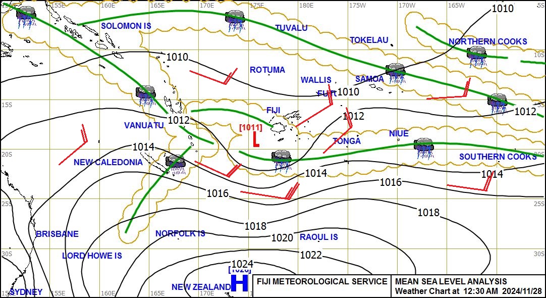
In the South Pacific, the Convergence Zone SPCZ is starting to reactivate after a quiet period. It is likely to bring some heavy rain to Solomons tonight and Monday and to stretch eastwards along 10 to 15S reaching Tuvalu and Tokelau by early next week and towards northern Cooks by late next week 20-21 September.
This week we have the opportunity to see the transformation of a Convergence zone CZ into a trough.
A CZ is likely to form over Fiji and Tonga on Wednesday. This feature starts off as an extension of the SPCZ. A convergence zone is a feature that is marked by zone of converging surface air. This air piles upwards and then outwards creating a zone of enhanced convection. As air travels through a CZ it usually doesn't change direction much, and the CZ usually lingers around the same place.
During Thursday this CZ is likely to turn into a trough. That is to say that the air pressure lowers along its midriff, and there is a marked difference in wind direction across the convergence zone, with, in this case, NE surface winds on one side and SE winds on t'other. Also the whole system starts to move – in this case southeastwards due to the net NW winds at cloud level. A low is then expected to form late Thursday (UTC) near 25S 165W and deepen as it peels off to the SE , propelled by the upper winds and taking some of the moisture-energy of the CZ away with it to cause chaos in the Southern Ocean. The remains of the CZ are expected to turn into a trough that goes east and weakens, reaching French Polynesia by Sat 15 Sep.
If you are still in Tahiti and thinking about your voyage to Tonga in the next month or so, then watch this event closely and try and avoid a repetition of it during your voyage (Island hop between the troughs if you can).
SUBTROPICAL RIDGE STR
The STR lies between the trade winds and the roaring 40s. There have been some well formed highs travelling along the STR along 25 to 30S recently. One of these is now near south of FP and moving east.
The next is forming in the western Tasman Sea, but seems likely to form a centre near 42S on Tuesday. This High, combined with a low to southeast of NZ, should shovel some polar chilled air from near 60S onto the South Island . The High centre is expected to cross the North Island on Thursday 13 Sep and then move eastwards along 33S , followed by a Low that should form in the mid Tasman Sea on Friday 14 Sep.
NZ/Tasman Sea
The disturbed westerly winds of the roaring 40s are likely to bring a burst of SW swell into the Tasman Sea on Monday and Tuesday, and a low forming in the mid Tasman sea on Friday should cross the North Island on Saturday and Sunday. That really only leaves Wednesday and Thursday as good days for arriving/departing Northland.
>>>>>>>>>>>>>>>>>>>>>>>>>>>>>>>>>>>>>>>>>>>><<<<<<<<<<<<<<<<<<<<<<<<<<<<<
And now for some additional notes to what I wrote last week about obtaining weather maps via email. You may have invested in a some radio fax software such as Xaxero http://xaxero.com/downloads.htm or JVcom http://www.jvcomm.de/ or MScan http://www.mscan.com/ for downloading the sound from your shortwave radio and viewing it on your laptop, That's good. And there is also anap for your iPad called marine weatherfax viewer HD which might work – I can't vouch for it yet.
Winlink may allow you to download some radiofax maps via email as TIFF files from Noaa.
The list of instructions are at http://weather.noaa.gov/pub/fax/ftpmail.txt but there really are no maps that will help is the south pacific.
The Bureau of Meteorology Australia analysis maps for the South Pacific are
http://www.bom.gov.au/difacs/IDX0532.gif
and http://www.bom.gov.au/difacs/IDX0032.gif
And the Fiji analysis maps are at
http://www.met.gov.fj/aifs_prods/0992.jpg (3pm)
http://www.met.gov.fj/aifs_prods/0991.jpg (noon)
and http://www.met.gov.fj/aifs_prods/0990.jpg (6am)
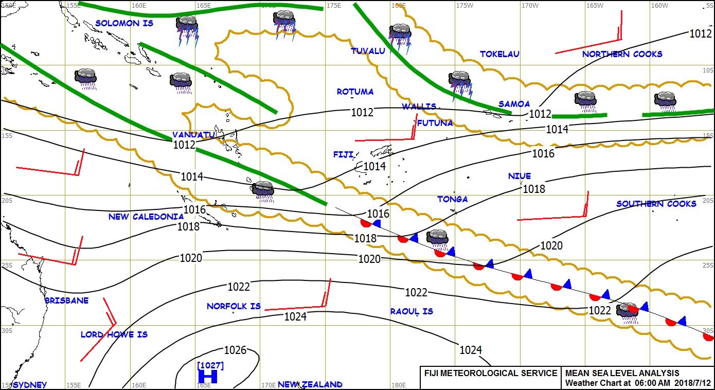
Here's one for show :
See my yotpak at http://www.boatbooks.co.nz/weather.html for terms used.
Weathergram with graphics is at http://metbob.wordpress.com/
Weathergram text only http://weathergram.blogspot.co
Website http://www.metbob.com
Feedback to bob@metbob.com
Followers
Translator
Bob McDavitt's ideas for sailing weather around the South pacific
09 September 2012
Subscribe to:
Post Comments (Atom)
No comments:
Post a Comment