WEATHERGRAM
YOTREPS
Compiled Sun 05 February 2017
Bob McDavitt's ideas for sailing around the South Pacific.
Disclaimer: Weather is a mix of pattern and chaos; these ideas are from the
patterned world.
During Jan 2017, the Subtropical ridge moved south in the Indian Ocean and
slight south in the South Pacific as compared to its December position, but also
weakened a bit in the Tasman Sea area. The anomaly maps for January around the
Tasman Sea are much the same as in December-and that explains the continuation
of the strong westerly flow over southern New Zealand. Over Indian
Ocean/Western Australia the trend id for an easing and easterly travel in the
troughiness.
Average isobars for 30 days and their anomalies may be seen at
www.esrl.noaa.gov/psd/map/images/fnl/slp_30b.fnl.html
There is now a strange "face-like figure' in the Northern Pacific, with
something strange happening over California.
January rain has been less than normal over the Indian ocean equator, The South
Pacific Convergence zone and the ITCZ. This is consistent with the late start
in the South pacific cyclone season.
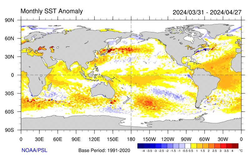
There is a rough link between the rain anomalies and the Sea surface temperature
anomalies (except around western South Island of New Zealand). Sea surface
temperature anomalies suggest that the Fiji to Southern Cooks area may be at
increased risk of cyclogenesis during (mid to late) February.
as seen at www.esrl.noaa.gov/psd/map/images/sst/sst.anom.month.gif
Tropics.
A Madden Julian Oscillation of increased convection is now being forecast to
strengthen this week and travel east across Australia and into the Western
Pacific later this month, building convective activity.
This is already producing some near -equatorial NW to Northerly wind burst over
NW Australia and in the South Pacific, as shown in tonight's windyty.com
imagery:
The probability of a tropical cyclone in the Coral Sea between 19 and 25 Feb has
been estimated by Meteo France to be up to 50%, as seen at
www.meteo.nc/nouvelle-caledonie/cyclone/coin-des-experts
In the Indian Ocean TC CARLOS is travelling mostly southwards to east of
Madagascar.
It is a sign that a new MJO is travelling east towards Australia.
Activity in the tropics is increasing to NW of Australia, and is easing to very
quiet along the ITCZ across central Pacific. Rain for the past week is at
trmm.gsfc.nasa.gov/trmm_rain/Events/big_global_accumlation.gif
WEATHER ZONES
SPCZ=South Pacific Convergence zone.
SPCZ is showing signs of increasing intensity over Coral Sea/Fiji/Tonga/Niue and
Southern Cooks. A depression may form in Coral Sea by Wednesday and the weaken.
Tropical accumulated rainfall for next week is at windyty.com
Subtropical ridge (STR)
The High east of North island tonight is travelling off to east along 40S from
Monday/ New Zealand day, followed by a strong NW flow over central NZ on Monday
and then a weakening trough on Tuesday.
New HIGH is expected to travel east of Tasmania into South Tasman Sea on
Wednesday, preceded by a south/Southeast flow over North Island. The High's
isobars should squeeze around Southland on Wednesday and then travel east to
east of South Island along 45S on Thursday.
Another High should cross central Tasman sea on Friday and skirt northern NZ on
Sat/Sun 11/12 Feb.
Tasman Sea/NZ Area troughs.
Trough is expected to cross South Island on Monday and fade over central NZ on
Tuesday.
Next trough is expected to reach SW of NZ on Friday and fade away on Saturday
before reaching central NZ.
SO, rain over NZ this week is less than it has been recently.
Even so, the outlook for next week is for several active fronts.
>>>>>>>>>>>>>>>>>>>>>>>>>>>>>>>>>>>>>>>>>>>>>>>>>>>>>>>>
Follow me on Facebook at www.facebook.com/metbobnz/
See my yotpak at boatbooks.co.nz/weather.html for terms used.
See my website www.metbob.com for information on tailor-made voyage forecasts-
Feedback to bob@metbob.com.
Tell anyone you like that to subscribe they should email me.
Weathergram text only (and translator) is at weathergram.blogspot.co.nz.
Weathergram with graphics is at metbob.wordpress.com,
Click FOLLOW at bottom right to subscribe.
To unsubscribe from WordPress: click the "unsubscribe" link on the bottom of the
email. Or, if email wasn't from WordPress then send a reply email saying LEAVE.
>>>>>>>>>>>>>>>>>>>>>>>>>>>>>>>>>>>>>>>>>>>>>>>>>>>>>>>>>>>>
Followers
Translator
Bob McDavitt's ideas for sailing weather around the South pacific
05 February 2017
Subscribe to:
Post Comments (Atom)
No comments:
Post a Comment